Romers (Map Graticules)
Now you can accurately obtain those elusive 1/10 divisions when generating grid references.
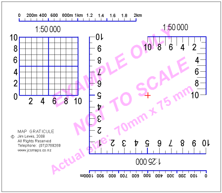
Heavy duty transparent laminated plastic sheet. Actual size of the 1:50 000 scale map grid square is 20mm x 20mm which represents 1 square km on a map. Line intervals are 2mm apart (representing 100 metres on the ground).
Used by Search & Rescue (LandSAR), DOC, Trampers, NZ Mountain Safety Instructors, & Scouts throughout NZ.
How to use them – Click here to see the diagram below
 Type A
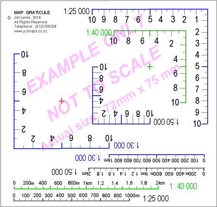
 Type B
 Type C
You’ll probably need a few – one for your pack and one for trip planning.
Buy some for your tramping/hiking mates. It’s a great Birthday, Mother’s/Father’s Day, Christmas present for someone who has everything.
Scales:
A: 1:50 000 and 1:25 000
B: 1:50 000, 1:40 000, 1:25 000
C: 1:25 000, 1:30 000, 1:40 000 and
1:50 000
D: 1:50 000 and 1:250 000
Other scales can be produced.
Cost (NZ prices only) – based on the formula (2.5n + 2) where n is the number of Romers required. Add $4.50 for postage & packaging. All prices include GST.
1 unit costs $4.50
2 units cost $7.00
3 units cost $9.50
4 units cost $12.00
10 units cost $27.00 etc
How to order:
Please supply your snail mail address, the number of units required and the scales.
An Invoice will be supplied with the Romers. Payment can be made by
Direct Credit to my bank account (details with the invoice).
Click here to email an order, or to ask a question.
How to use them: (see the diagram below)
Place the tip of the scale over the feature you want to find the grid reference for (e.g. the high point 1496m). Make sure the Romer scale lines are parallel to the blue vertical and horizontal grid lines on the map.
Read the numbers off the Romer where the map grid lines intersect the scale.
NOTE: Eastings (vertical grid line numbers) come before Northings (horizontal grid line numbers).
A jingle to help remember the order:
You go across the valley (numbers going across the map in an easterly direction) before climbing the hill (numbers going up the map in a northerly direction)
or: You crawl (horizontal/eastings) before you walk (vertical/northings)

Getting a 6-figure Grid Reference from a GPS
A GPS generates a 14 digit co-ordinate:
For example: 1824628E 5654815N
Delete the first two and last two numbers of the Easting and Northing set. You are left with six numbers which can be used on the map.
1824628E 5654815N
The 6-figure map grid reference is: 246548
(see the map above).
Each 7-digit number represent the number of metres from the Geodetic 2000 reference point.
Getting a 6-figure Grid Reference from a map into a GPS
We will use the 6-figure map grid reference from the map above: 246548
Add two zeros after the middle three numbers (Eastings) and another two
zeros after the last three numbers (Northings) that were in the 6-figure
grid reference.
1824600E 5654800N
Note: This will gave an approximate location.
The 18 and 56 numbers can be found in the bottom left hand corner of the Topo50 map.

Visitors:
